TAS 5624 – Murdunna For Sale
- Estimated Delivery : Up to 4 business days
- Free Shipping & Returns : On all orders over $200
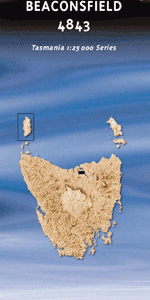
This Topographic Map is produced by the Department of Primary Industries, part of the Tasmanian Government.
These maps are an important resource for Government, industry, and the public. They are used for environmental and emergency management, farm planning and mineral exploration. They are also popular for recreational users such as bushwalkers, mountain bike and horse riders.
The PDF version of this can be printed at home or sent to a professional printer for a 100% scale reproduction.
At this scale, 4cm on this map represents 1km on the ground. A standard map (which is square) covers an area of approximately about 12.5km by 12.5km, with a contour interval of 10m. This map contains natural and constructed features including road and rail infrastructure, vegetation, hydrography, contours, localities and some administrative boundaries.
Duck Creek Dunalley Bay Dunalley Beach Dunbabin Point Bellettes Bay Bellettes Creek Bellettes Point Blackman Hill Blackman Rivulet Bobs Gully Browns Creek Bun Hill Cape Surville Carlisle Beach Chasm Creek Chronicle Point Conical Hill Daltons Beach Deep Glen Bay Deep Glen Bluff Deep Glen Creek Fazackerleys Range Flinders Bay Flinders Creek Forestier Peninsula Franks Knob Grave Island Fulham Island Gellibrands Marsh Goat Hill Goslings Flat High Yellow Bluff Humper Bluff Jacks Gully Jimmys Hill Jimmys Spur King George Island King George Sound Lizard Hill MacGregor Peak Machins Hill McGuinness Creek Mount Forestier Mount Reynolds Murdochs Hill Murdunna Murdunna Hill Norfolk Bay Pauls Hill Salty Creek Scrimgers Creek Sisters Bay Sisters Rocks Slew Hill Smooth Island Sommers Bay Sommers Beach Sounds Rivulet Stroud Point Vee Gully View Peak Waldemar Reef Walters Opening Wellard Bridge Wellard Rivulet Wiggins Point Yellow Bluff Creek Arthur Highway Bridge Bradys Lookout Castle Rock Hyatts Grass Shelly Beach Top Waterfall Bay Yellow Bluff Creek Forest Reserve Camden Creek Camden Brook Gilpins Creek East Bay Neck Low Island Green Island Yellow Bluff Forestiers Peninsula Garden Island Gull Island King Georges Island King Georges Sound The Sisters Sisters Sisters Islets Macgregor Peak
| Title | Pdf Download |
|---|