TAS 5623 – Taranna Online now
- Estimated Delivery : Up to 4 business days
- Free Shipping & Returns : On all orders over $200
This Topographic Map is produced by the Department of Primary Industries, part of the Tasmanian Government.
These maps are an important resource for Government, industry, and the public. They are used for environmental and emergency management, farm planning and mineral exploration. They are also popular for recreational users such as bushwalkers, mountain bike and horse riders.
The PDF version of this can be printed at home or sent to a professional printer for a 100% scale reproduction.
At this scale, 4cm on this map represents 1km on the ground. A standard map (which is square) covers an area of approximately about 12.5km by 12.5km, with a contour interval of 10m. This map contains natural and constructed features including road and rail infrastructure, vegetation, hydrography, contours, localities and some administrative boundaries.
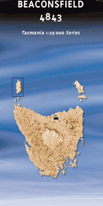
Hillcrest Eaglehawk Neck Penzance Allans Creek Eaglehawk Bay Eaglehawk Bay-Flinders Bay Cons … Eaglehawk Spur Blowhole Creek Boxalls Bay Burgess Creek Camp Falls Cascades Bay Cascades Rivulet Cashs Lookout Clemes Peak Clydes Island Daleys Creek Dart Island Dart Island State Reserve Devils Kitchen Doo Town Egg Beach Eli Point Fergusons Bay Flat Rock Fossil Island Garfish Bay Glenila Point Grooms Hill Halfway Bluff Hawks Hill Heather Point Impression Bay Koonya Koonya Beach Lichen Hill Little Norfolk Bay Lockes Creek Lufra Cove Mackerel Islets Mason Point Mason Rock Morleys Lookout Newmans Beach Norfolk Creek Norfolk Point Noyes Creek Osprey Head Parkers Beach Parkinsons Point Patersons Arch Pirates Bay Premaydena Premaydena Point Premaydena Point Historic Site Prices Bay Quarrells Point Shelly Beach Shower Falls Single Tree Point Susan Gully Sympathy Hills Sympathy Hills Private Nature R … Sympathy Point Taranna Taranna Creek Tasman Blowhole Tasmans Arch Tatnells Creek Tatnells Hill Tessellated Pavement Thorntons Hill Tinpot Island Waterfall Bay Waterfall Bluff Descent Beach Duck Creek Eaglehawk Bay State Reserve Eaglehawk Neck Historic Site Flinders Reef Newmans Creek Bridge Pirates Bay Nature Recreation Area Stony Point Taranna Creek Bridge Tasmanian Devil Park Tessellated Pavement State Reserve Eaglehawk Bay-Flinders Bay Conservation Area Clydes Islands Saltwater River Woody Island Price Bay Tasman Arch Sympathy Hills Private Nature Reserve Cascades Creek Newman Creek Signal Hill
| Title | Pdf Download |
|---|