TAS 5425 – Carlton For Sale
- Estimated Delivery : Up to 4 business days
- Free Shipping & Returns : On all orders over $200
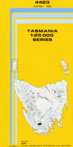
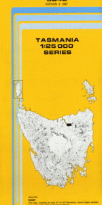
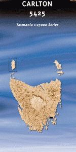
This Topographic Map is produced by the Department of Primary Industries, part of the Tasmanian Government.
These maps are an important resource for Government, industry, and the public. They are used for environmental and emergency management, farm planning and mineral exploration. They are also popular for recreational users such as bushwalkers, mountain bike and horse riders.
The PDF version of this can be printed at home or sent to a professional printer for a 100% scale reproduction.
At this scale, 4cm on this map represents 1km on the ground. A standard map (which is square) covers an area of approximately about 12.5km by 12.5km, with a contour interval of 10m. This map contains natural and constructed features including road and rail infrastructure, vegetation, hydrography, contours, localities and some administrative boundaries.
Studley Park Frankston Inala Milford Gillingbrook Homewood Shasta Farm Riverside Carlton House Dodges Ferry Seven Mile Beach Acton Creek Dorman Point Bally Park Bedding Hill Blue Lagoon Boathouse Hill Carlton Carlton Beach Carlton Bluff Carlton River Chaseys Creek China Creek China Tier Clarks Bay Connellys Bay Connellys Creek Connellys Marsh Cuttyjong Creek Dixons Hill Dodges Hill Five Mile Beach Flaggy Creek Gunns Hill Gunns Point Gwynns Point Gypsy Bay Hobart Airport Isle Of Caves Isle of Caves Nature Reserve Jones Bay Lewis Park Lewisham Little Spectacle Island Llanherne Golf Course Lovely Bottom Mile Beach Okines Beach Park Beach Pickety Hill Pretty Jacks Primrose Beach Primrose Point Primrose Sands Red Ochre Beach Renard Point Roches Beach Royal Hobart Golf Course Samuel Thorne Reserve Sandy Point Sawpit Creek Single Hill Single Hill Coastal Reserve Spankers Hill Spectacle Head Spectacle Island Spectacle Islands Spectacle Islands Nature Reserve Springs Creek Steeles Hill Steeles Island Steeles Sugarloaf Susan Bay Tanners Creek Thornes Hills Tiger Head Tiger Head Bay Tiger Head Beach Townsends Lagoon Valleyfield Hill Whale Rock Wharmbys Creek Wykeholm Hill Bambra Reef Llanherne Red Hill Seven Mile Beach Protected Area Tanner Creek Bridge The Marsh The Bluff Simmonds Point Wombat Creek Spectacle Islet Roaring Beach Caves Island Cares Island Isle of Caves Point Renard Albert Point
| Title | Pdf Download |
|---|