TAS 5219 – Fluted Cape Cheap
- Estimated Delivery : Up to 4 business days
- Free Shipping & Returns : On all orders over $200
This Topographic Map is produced by the Department of Primary Industries, part of the Tasmanian Government.
These maps are an important resource for Government, industry, and the public. They are used for environmental and emergency management, farm planning and mineral exploration. They are also popular for recreational users such as bushwalkers, mountain bike and horse riders.
The PDF version of this can be printed at home or sent to a professional printer for a 100% scale reproduction.
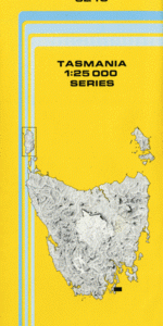
At this scale, 4cm on this map represents 1km on the ground. A standard map (which is square) covers an area of approximately about 12.5km by 12.5km, with a contour interval of 10m. This map contains natural and constructed features including road and rail infrastructure, vegetation, hydrography, contours, localities and some administrative boundaries.
Adventure Bay Cookville Adventure Bay Beach Arched Island Dorloff Creek East Cove Bay Of Islands Blackfellows Point Blighs Creek Cape Connella Captain Cook Creek Darlings Lookout Daveys Hill Fluted Cape Grays Bluff Haulage Bay Jack Jones Creek Kadens Corner Mangana Bluff Mavista Falls Midway Creek Mount Banks Mount Cook Mount Mangana Mount Midway Mount Tobin Saintys Creek Sheepwash Creek South Bruny South Bruny National Park South Bruny Range Turnip Gully Waterfall Creek Waterfall Creek State Reserve Mount Mangana Forest Reserve Mount Midway Forest Reserve The Slide Cook Creek South Bruny Island Cape Conella Cloudy Lagoon
| Title | Pdf Download |
|---|