TAS 4428 – Gordonvale Online now
- Estimated Delivery : Up to 4 business days
- Free Shipping & Returns : On all orders over $200
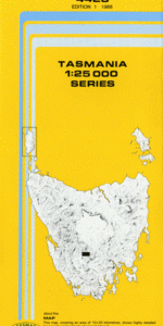
This Topographic Map is produced by the Department of Primary Industries, part of the Tasmanian Government.
These maps are an important resource for Government, industry, and the public. They are used for environmental and emergency management, farm planning and mineral exploration. They are also popular for recreational users such as bushwalkers, mountain bike and horse riders.
The PDF version of this can be printed at home or sent to a professional printer for a 100% scale reproduction.
At this scale, 4cm on this map represents 1km on the ground. A standard map (which is square) covers an area of approximately about 12.5km by 12.5km, with a contour interval of 10m. This map contains natural and constructed features including road and rail infrastructure, vegetation, hydrography, contours, localities and some administrative boundaries.
Gordonvale Arndell Creek Eden Creek Beginners Luck Cave Cashions Creek Cashions Creek Cave Chicken Hill Currawong Ridge Dawson Settlement Diamond Lake Florentine Great Dome Gells Lookout Lake Rhona Lanes Peak Lavara Tarn Lawrence Rivulet Mount Wright Nunamira Cave Reeds Creek Richea Creek Station Marsh Stepped Hills Surprise Lake Welcome Stranger Cave Wright Arches Lawrence Rivulet Cave Lawrence Rivulet Forest Reserve Mount Misery Gordon Range Tiger Range Valley of Rasselas Lawrence Creek
| Title | Pdf Download |
|---|