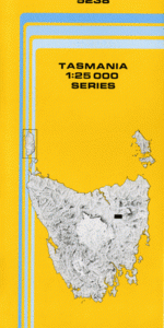
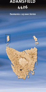
TAS 4426 – Adamsfield Supply
- Estimated Delivery : Up to 4 business days
- Free Shipping & Returns : On all orders over $200
This Topographic Map is produced by the Department of Primary Industries, part of the Tasmanian Government.
These maps are an important resource for Government, industry, and the public. They are used for environmental and emergency management, farm planning and mineral exploration. They are also popular for recreational users such as bushwalkers, mountain bike and horse riders.
The PDF version of this can be printed at home or sent to a professional printer for a 100% scale reproduction.
At this scale, 4cm on this map represents 1km on the ground. A standard map (which is square) covers an area of approximately about 12.5km by 12.5km, with a contour interval of 10m. This map contains natural and constructed features including road and rail infrastructure, vegetation, hydrography, contours, localities and some administrative boundaries.
Adamsfield Conservation Area Coopers Creek Corkscrew Hill Curtain Creek Fossil Lake Frodshams Pass Ibsens Peak Kallista Creek Lavelle Creek Little Florentine River Lumsden Creek Millen Creek Mount Mueller Needles Picnic Ground Pontoon Hill Ragged Basin Ragged Range Salvation Creek Saw Back Creek Saw Back Range Scanlon Creek Stacey Lookout The Needles Welcome Rock Welsh Creek Worsley Creek Black Creek Fenton Gully Prince of Wales Cap Reeces Corner Second Boyd River Seventeen Mile Creek Stacey Gully Stringybark Forest Reserve Williams Creek Lanham Creek Adamsfield Myrtle Creek Staceys Lookout Mueller Range Rugged Range High Rocky Conical Hill
| Title | Pdf Download |
|---|