TAS 3446 – Lileah Supply
- Estimated Delivery : Up to 4 business days
- Free Shipping & Returns : On all orders over $200
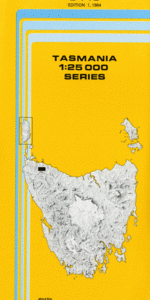
This Topographic Map is produced by the Department of Primary Industries, part of the Tasmanian Government.
These maps are an important resource for Government, industry, and the public. They are used for environmental and emergency management, farm planning and mineral exploration. They are also popular for recreational users such as bushwalkers, mountain bike and horse riders.
The PDF version of this can be printed at home or sent to a professional printer for a 100% scale reproduction.
At this scale, 4cm on this map represents 1km on the ground. A standard map (which is square) covers an area of approximately about 12.5km by 12.5km, with a contour interval of 10m. This map contains natural and constructed features including road and rail infrastructure, vegetation, hydrography, contours, localities and some administrative boundaries.
Ridgeway Alcomie East Creek Beatties Hill Black River Blizzards Creek Coopers Hill Copper Creek Dip River Edmonds Creek Eurebia Greenes Hill Gentle Annie Creek Gibson Creek Harbour Creek Irishtown Johns Hill Kellys Knob Lileah Maguires Creek Meanys Hill Mount Lileah Nabageena O Hallorans Hill Peppermint Hill Richards Creek Scantlebury Hill Sharmans Hill Spinks Hill Sunny Hills Turners Plain Vales Creek Waterwheel Creek Willis Hill Beatties Lookout Lileah Trig O Briens Corner O Connor Hill Pine Corner Savage River Pipeline Stony Creek Young Hill Edith Creek
| Title | Pdf Download |
|---|