PNG 513 – Bonvouloir Islands To Normanby Island Including Egum Atoll Supply
- Estimated Delivery : Up to 4 business days
- Free Shipping & Returns : On all orders over $200
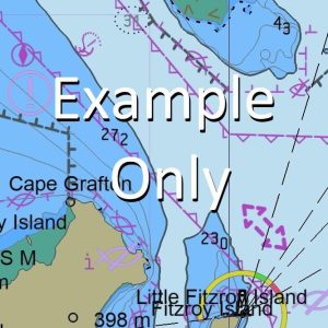
This official Nautical Chart is produced by the Australian Hydrographic Office, and corrected fortnightly to Notice to Marines by Cairns Charts & Maps. This ensures it remains compliance with Safety of Navigation requirements. This marine chart, or sea map , is primarily produced to support the safe navigation of commercial shipping through Australian, Papua New Guinea and Solomon Island waters.
Nautical charts depict the seabed, or bathymetry, using a variety of colours to shade the depth regions. Darker blues indicate shallower water, while light blues and white indicate deeper water. A chart will also show continuous contour lines (at varying intervals depending on the scale of the chart), spot depths across the whole area, as well as different symbols indicating wrecks, shallow rocks and dangers, as well as details on lights, light houses, tides and currents.
For extensive detail on the symbology of nautical charts, the Symbols and Abbreviations used on Admiralty Charts is the definitive reference.
Wenasia Point Unasia Point Weioko Bay Tupwalogi-Ia Tupwalogi-ia Mission Soisoi Bay Sipupu Bay Sewataitai Sehulea SXH Saukea Sanaroa Cape Pierson Babaclinai Point Panemote Island Nasakori Island Panemate Nedakolana Island Mwalukwasia Bay Marupwasia Bay Mudamudara River Malaha River Kwaiahia River Kenolia Kaura Bay Ibuwar River Ibuwa River Hokoa Point Granawe Point Etabu Point Etabu Bay Egum Islet Egum Island Dibuwa River Bwaruada Point Baradua Point Dowada Bay Sobulasi Bay Welololowa Point Weihu Wawamouna Walaulau Bay Ventenat Islands Digara gara Cape Ventenat Cape D Entrecasteaux Cape DEntrecasteaux Cape d Entrecasteaux Cape dEntrecasteaux Karitahua Cape Tupabololi Bay Tubabori Talaha Tabudaia Point Tabubaia Point Sumwaraki Point Strathord Islands Somwadina Small Island Skarakara Point Skarakaragi Point Sinada Point Sewai Sekwia Kwioa Point Sawatupwa River Sawatupwa Sawatupna Sawabwara Bay Rabia Bay Prevost Range Patumara Normanby Island Duan Duau Kwaiatabu Normandy Mwatebu Munaha Bay Makumaku Point Make-Ia Point Meke-ia Point Mekeya Point Liahane Lekwanwamuhuwa Lekwahwamuhuwa Leapwaapwa Lawadi Kwahaula Kwadewalai Kurada Kumaru Bay Kumapau Korowau Bay Makedakwadakwa Bay Kokua Point Kokouwa Point Kokova Point Ketch Island Kerorogea Kasi Kasi Bay Kasikasi Kalotau Bay Jack Island Ialohia Iakini Hatulawalai Gulemalamalalana Point Guleguleu Gulekulubo Grind Reef Nuremarema Reef Gogoialeba Point Magadebwana Point Godumuri Gimogimowo Gigowa Gelawadedena Ganimwala Frierua Bay Flounder Reef Eruerauwa Bay Elologea Bay Elasi Elasi Mission Dowatai Point Damatai Dotaona Bay Delina Point Degola Centipede Bay Gadimuru Bay Gudimuru Bunama Bay Bunamo Bay Bunama Bunama Villages Bunamo Village Burnamo Village Budiai Biawa Bay Bihauwa Bay Biauwa Barabara Barabara Villages Badilai Babagai Awaiara Bay Sawataitai Bay Sewataitai Bay Lihuai Point North Island Panomole Island Amatuna Island Middle Island
| Title | Paper, Flat Paper, Laminated |
|---|