TAS 5234 – Ellinthorp Sale
- Estimated Delivery : Up to 4 business days
- Free Shipping & Returns : On all orders over $200
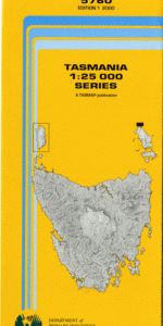
This Topographic Map is produced by the Department of Primary Industries, part of the Tasmanian Government.
These maps are an important resource for Government, industry, and the public. They are used for environmental and emergency management, farm planning and mineral exploration. They are also popular for recreational users such as bushwalkers, mountain bike and horse riders.
The PDF version of this can be printed at home or sent to a professional printer for a 100% scale reproduction.
At this scale, 4cm on this map represents 1km on the ground. A standard map (which is square) covers an area of approximately about 12.5km by 12.5km, with a contour interval of 10m. This map contains natural and constructed features including road and rail infrastructure, vegetation, hydrography, contours, localities and some administrative boundaries.
Ashby Ellinthorp Frankston Williamwood Roseneath Verwood Ellensworth Horton Somercotes Ferndale Wetmore Abbotts Creek Bar Lagoon Bells Lagoon Blue Gate Marsh Bradys Pass Brown Hills Chock n Log Gully Clarks Lagoon College Hill Elbow Lagoon Ellinthorp Plains Ferndale Creek Folly Lagoon Forest Lagoon Greens Creek Grimes Sugarloaf Gavins Sugarloaf Gavins Tier Hanging Sugarloaf Horton Hill Joes Creek Kitchener Ridge Little Lagoon McGhies Gully Mrs Teddys Lagoons Near Lagoon Oakden Hill Pump Lagoons Reedy Lagoon Silo Lagoon Snobs Point Splitters Marsh Steeles Bluff Sugarloaf Spur Sweet Flat Tiger Spur Tomb Hill Verwood Forest Weedy Lagoon White Kopje White Lagoon Cobbs Tier Cockpit Plains Limekiln Hill Macquarie River Bridge Ross Bridge Tacky Bridge The Point The Slack White Spur Gavin Creek Green Creek
| Title | Pdf Download |
|---|